
Finding Collin County Streets
Start a street directory search by normalizing the address: house number, street name, directional, suffix, unit, city, and ZIP. USPS is the place to verify a postal form; the county map supplies geography. CCAD then ties the location to a parcel and tax-roll owner. For a road segment, search CCAD by Street Number and Street Name, leaving off prefix, suffix, and unit number from the street-name field. Narrowing with a subdivision, neighborhood, property ID, or geographic ID is useful in a large county.
Once CCAD returns a parcel, note the situs address, mailing address, current owner spelling, legal description, subdivision, lot or block, and tax year. The situs is the parcel location. The mailing address is where the tax notice goes. A nonlocal mailing address may be useful correspondence information, but it does not prove where an owner lives. That split is the core caution in any current Collin County street directory result.
- Confirm postal spelling with USPS ZIP Lookup.
- Search the address at Collin Central Appraisal District.
- Open the county map and record parcel or legal-description clues.
- Search the owner as grantee and grantor in the Clerk index.
- Use permits, election records, and historical directories only for the limited role each source documents.
Collin County CCAD Street Search
CCAD’s public search has no login requirement and supports owner name, street number, Street Name, property ID, geographic ID, legal description, subdivision, condominium, neighborhood, abstract, mobile-home park, DBA, tax year, and advanced protest or hearing fields. Its street method is intentionally plain: do not add a prefix, suffix, or unit number to Street Name. A name search can use the last name first, but a street directory search should keep the parcel reference close at hand before moving to a deed.
| Search field | Street-directory use |
|---|---|
| Street Number | Matches the house-number component. |
| Street Name | Use a simple name without prefix, suffix, or unit. |
| Subdivision | Narrows a common street to its platted area. |
| Property or Geographic ID | Fixes the search on one mapped parcel. |
| Legal Description | Provides the bridge to a deed or plat. |
| Neighborhood and Tax Year | Advanced filters for crowded results. |
CCAD’s property search shows the owner, address, ID, legal-description, subdivision, and advanced controls used in this sequence.
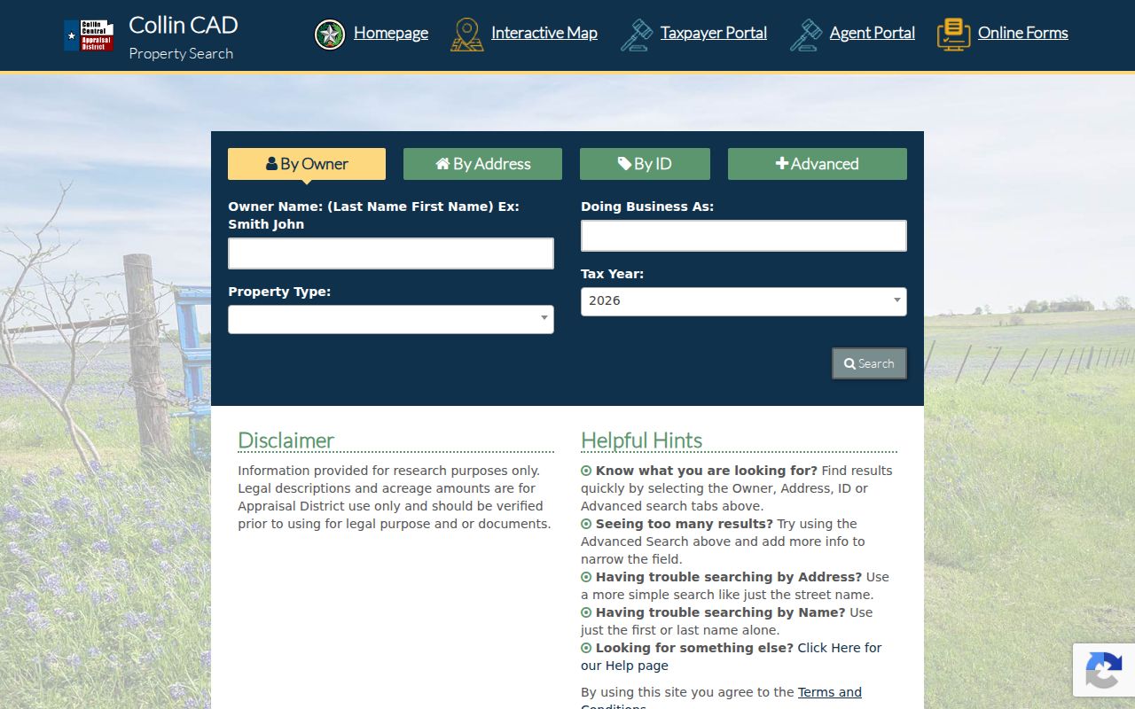
The form is a parcel-search starting point, not a household directory or a guarantee that every parcel card exposes the same fields.
Collin County Map Parcels
The Collin County GIS map service lists Subdivisions, Parcels, and Abstracts layers. Turn on Parcels and the relevant subdivision layer, zoom to the road, and use Identify on a parcel. The service also lists ZIP Code, ETJ Boundary, municipalities, schools, cemeteries, ISD boundaries, and other layers. These overlays explain why an address can sit near a city edge or carry a postal name that does not match its government route.
The map supports Query, Find, and Export Map operations and records a maximum selection of 2,000. It is useful for geometry and adjacent-parcel context. It is not certified title evidence. Take legal-description or ownership questions back to CCAD and the County Clerk. Note: the GIS service does not state a historical coverage start for each parcel update.
Collin County Deeds by Address
A deed is often not searchable by the modern street address. Use CCAD to obtain the current owner, subdivision, lot or block, abstract, or legal description. Then search the County Clerk PublicSearch index for the owner as grantee. The purchase deed identifies the grantor, who can then be searched as an earlier grantee. The same logic works along a street, but it follows recorded legal parties and parcel descriptions, not a reverse list of occupants.
PublicSearch offers a Search Term, date range, recent-date shortcuts, and a choice between Index Only and Index & Full Text OCR. It states that multiword index searches handle words separately. The live portal displayed certification through August 28, 2026 during inspection, but did not state a live-index start year. Its official guide directs 1843–1975 research to Historical Records. The Clerk, rather than the online screen, is the official repository for certified copies.
The land-record index shows its Search Term, recorded-date, scope, Search, and Reset controls.
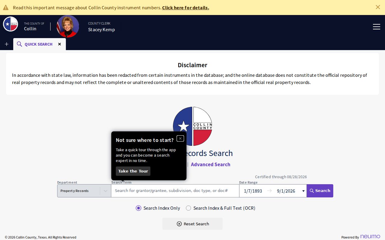
A search result should be read for the parties and instrument role before it is treated as evidence about a street address.
Collin County Address Records
Address-keyed records sit with different custodians. CCAD supplies the tax-parcel layer. GIS supplies geometry, adjacent parcels, subdivisions, abstracts, ZIP, municipality, and ETJ context. The Clerk index supplies instrument parties and legal descriptions. Development Services uses an address procedure for county unincorporated or ETJ development records, while incorporated cities control their own permit and code files. A permit can place an applicant, contractor, or project contact at a place and date. It does not establish a current resident.
| Address record | Keeper | What it can show | Access and caution |
|---|---|---|---|
| CCAD parcel | Collin CAD | Tax owner, mailing and situs, legal description, value, tax year | Free portal; result-card fields require live confirmation |
| GIS parcel | Collin GIS | Geometry, nearby parcels, subdivision and jurisdiction overlays | Free map and query; not certified title |
| Recorded instrument | County Clerk | Parties, document, recording date, legal parcel | Public index; Clerk for certified copy |
| Plat | Clerk and GIS | Lot, block, subdivision, and address bridge | Search or counter access |
| Permit or project | County or city | Project, applicant, status, attachments, and dates | Address portal or focused request |
The County FAQ says to use Public Records, enter a partial address, choose a candidate address, use Advanced Search, then review project links, tabs, and attachments. A no-result does not prove that work never occurred.
The county’s Development Services FAQ documents that address procedure. Its public CSS portal returned a 403 during research, so a reader who cannot reach a result should request a defined existing project or address range through the County’s Texas Public Information Act route. For an incorporated address, use the actual city’s permit or code office instead.
Collin County E911 Addresses
County GIS assigns rural emergency addresses and maintains the geographic database. Its documented history includes the 1985 CSEC, 1987 HB 911, 1991 cutover, 1992 GIS formation, 1993 road-name policy, 1995 rural-addressing shift to GIS, and the 2002 County Addressing Policy. In the current workflow, Development Services sends an application, GIS assigns the address, and GIS notifies Development Services, CCAD, USPS, and the citizen. That chain explains why a new address can appear in one system before another.
GIS reports a three-business-day goal for most address assignments and ten-day goals for annexation or deannexation updates. The 911-addressing page is the official reference for the county’s rural-address process.
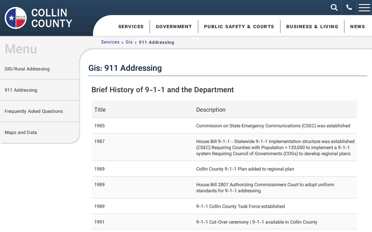
Addressing records establish a physical-location workflow, not a list of occupants.
Collin County Old Street Names
Older documents can use a street name that no longer appears on a modern map. Plano’s historic-streets material identifies K Avenue as Main, 15th as Mechanic, I south of 15th as Mill, Church before 1900, and Interurban, and 16th west of K as College. A directory or deed can appear to miss an address until the historic name and the current street are tested together. Lot, block, subdivision, parcel ID, and legal description are useful bridge terms when a name has changed.
For historical address work, the reverse or criss-cross directory is the printed address-to-household layer. The known McKinney and Plano runs are uneven, so pair a directory date with the deed chain, census, permit, or obituary. The historical volumes themselves are explained on the Collin County city directory page.
- Parcel
- A defined piece of land that the appraisal district and GIS service use as the basic property unit.
- Situs address
- The physical parcel location used by GIS, permits, and appraisal records.
- Plat
- A recorded map that lays out a subdivision, lot, block, or other legal geography.
- Legal description
- The land description used in a deed or plat and more stable than a street name.
- Criss-cross directory
- A reverse address listing that can lead to a historical name entry.
Collin County Street Directory Limits
A street directory cannot show every household member, people who do not own a parcel, unlisted telephone subscribers, utility customers, or private motor-vehicle data. The public voter lookup is name and date of birth rather than a street browse. A paid county voter file has controlled fields and use limits under Election Code section 18.009. A full file should not be represented as a public block map.
CCAD ownership, a deed party, a directory entry, and a permit applicant are different roles. Compare dates before linking them. The County Clerk also warns that online land images can contain redactions related to HB 4350 and may not be complete or unaltered.
Collin County Street Boundaries
A road name alone can cross a municipal boundary, an ETJ, a ZIP area, or an unincorporated pocket. The GIS service lists municipality, ETJ Boundary, ZIP Code, school, and district layers alongside parcels. Turn those on before selecting a permit, code, or court path. County Development Services serves unincorporated and ETJ work, while an incorporated city keeps its own permit and code records.
Use the map for the jurisdiction question and USPS for postal formatting. A ZIP or city name in a mailing label does not settle a city-limit question. This extra check prevents a street search from being sent to the county when the record is held by a city, or the other way around.
Collin County Street Registration Records
Election information is not a public browse-by-street map. The Collin voter lookup asks for a first name, last name, and date of birth. Its live form returned an error during inspection, so it is not a reliable path for a broad street pass. A paid Election Store file may contain registered and mailing addresses, districts, registration dates, and participation history, but that route has statutory use limits.
Use voter information only to confirm the limited registration fact it supports. Protected voters and Address Confidentiality Program participants can have address restrictions. A tax-roll owner, recorded deed party, and registered voter remain separate record roles even when the same street address appears in more than one system.