
Collin County ZIP Code Coverage
The county's official ZIP map, dated March 22, 2022, is an illustrative postal map rather than a tool for deciding a boundary dispute. Its rows are useful for orienting a search because they show the postal areas displayed across Collin County, including places that reach beyond a simple city list. A ZIP code is delivery geography. It can cross a city or county edge, and it may cover more or less ground than the town name printed on an envelope. The real county map rows are grouped here where the map groups them.
| ZIP | Areas Covered | Post Office | Notes |
|---|---|---|---|
| 75002, 75013 | Allen | Allen-area USPS | Postal geography is not the Allen limit. |
| 75409 | Anna | Anna | Check the specific street assignment. |
| 75424 | Blue Ridge | Blue Ridge | Rural postal coverage. |
| 75135 | Caddo Mills | Caddo Mills | Map area reaches beyond a simple Collin city list. |
| 75007 | Carrollton | Carrollton | North Dallas-area postal geography. |
| 75009, 75019, 75021 | Celina | Celina-area USPS | 75019 and 75021 may cross municipal or county context. |
| 75172 | Copeville | Copeville | Postal place differs from incorporated-city concepts. |
| 75248, 75252, 75287 | Dallas | Dallas-area USPS | Not confined to a Collin municipality. |
| 75442 | Farmersville | Farmersville | Confirm the exact route. |
| 75033, 75034, 75035, 75036 | Frisco | Frisco | Several ZIPs span an expanding city. |
| 75164 | Josephine | Josephine | Check the postal and county edge. |
| 75069, 75070, 75071, 75072 | McKinney | McKinney | McKinney does not have one ZIP boundary. |
| 75454 | Melissa | Melissa | Confirm a new-development street. |
| 75173 | Nevada | Nevada | Postal area. |
| 75023, 75024, 75025, 75075, 75093, 75094, 75097 | Plano | Plano | Historic streets and city limits need separate checks. |
| 75407 | Princeton | Princeton | Postal area may extend outside the municipal limit. |
| 75078 | Prosper | Prosper | Growing-area assignment needs USPS confirmation. |
| 75080, 75082 | Richardson | Richardson | Postal areas can overlap county and city geography. |
| 75087 | Rockwall | Rockwall | Map coverage is not identical to the county focus. |
| 75189 | Royse City | Royse City | Multi-county postal context is possible. |
| 75048 | Sachse | Sachse | City and ZIP are distinct layers. |
| 75495 | Van Alstyne | Van Alstyne | Check the county edge. |
| 75485 | Westminster | Westminster | Postal area. |
| 75097 | Weston | Weston | Shared with other displayed service areas. |
| 75098 | Wylie | Wylie | City ZIP and county boundary are separate layers. |
| 75491 | Whitewright | Whitewright | Postal area. |
Allen, Frisco, McKinney, and Plano each appear with more than one ZIP code. The map also displays Caddo Mills, Dallas, Rockwall, and Whitewright-type postal areas. That is why an address should not be assigned to a jurisdiction solely from its ZIP. A city mailing name can be useful context, but the parcel map and local government boundary layers answer a different question.
Verify a Collin County ZIP Code
USPS ZIP Code Lookup is the final check for a delivery address and its standardized mailing format. It has three routes: By Address, By City and State, and By ZIP. By Address accepts an optional company name and apartment or suite field, but requires the street address, city, state, and ZIP fields. Its result can standardize the address. It does not confirm that a person or company is present there.
| USPS lookup route | Inputs documented | Use for a Collin search |
|---|---|---|
| By Address | Company optional; street address required; apartment or suite optional; city, state, and ZIP | Confirm the delivery format for one known address. |
| By City and State | City and state | Start a postal-area check when an address is incomplete. |
| By ZIP | ZIP | Check the postal place associated with a known ZIP. |
The captured USPS ZIP Code Lookup screen shows a Find button for each route. Keep the returned postal formatting separate from ownership, voter registration, or municipal jurisdiction. Those records use their own sources and their own rules.
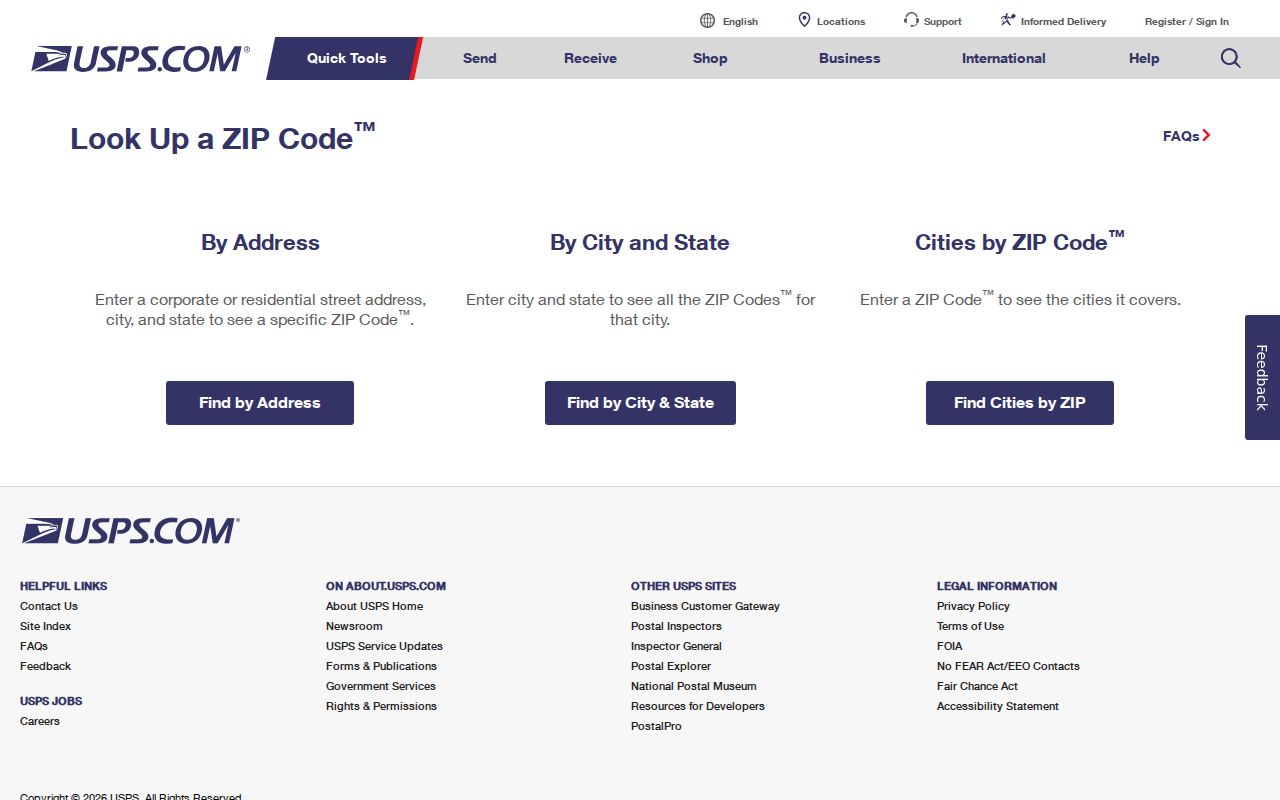
The USPS screen illustrates the distinct By Address, By City and State, and By ZIP options used to verify a postal assignment before following a county record trail.
Collin County ZIP Code GIS Layers
Collin County GIS supplies the geographic context a postal lookup cannot provide. The published Appraisal District map service includes ZIP Code, municipality, and ETJ Boundary layers alongside parcels, subdivisions, and abstracts. Turn on the ZIP Code layer with municipality or ETJ layers to see why a postal label and a local boundary can diverge. Parcels and subdivisions can then provide a more useful location clue for a property record.
The GIS service supports map identification, queries, text finding where configured, and map export. It also lists a maximum selection of 2,000 features. Map geometry is valuable for interpretation, but it is not a certified title record or a boundary ruling. When a legal boundary matters, use the responsible office rather than relying on a screen capture or an illustrative ZIP outline.
The Collin County GIS program links its maps, GIS services, and 911-addressing resources for this kind of geographic check.
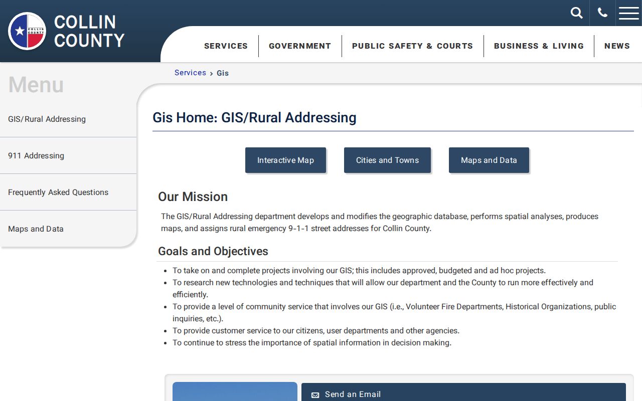
The program page is the county route for comparing ZIP coverage with map layers before treating a mailing label as a local jurisdiction.
Note: Use an official parcel, municipal, or ETJ source when a ZIP map and a stated city boundary appear to conflict.
Find Residents by ZIP Code
A ZIP code can narrow the area of a Collin County records search, but it is not a resident roster. Start with the postal format, then map the geography, then use the record system that fits the question. The public systems documented for Collin do not offer one universal ZIP-only name search. That limitation prevents a postal area from being mistaken for a list of occupants.
- Confirm the exact delivery format in USPS By Address when a street address is known. Save the ZIP as a geographic starting point, not proof of residence.
- Use the GIS ZIP Code layer with municipality and ETJ layers. Note the street, subdivision, parcel, or legal-description clue that places the address.
- Search Collin Central Appraisal District by street number and street name, subdivision, neighborhood, property ID, or legal description. Its inspected interface does not show a ZIP filter.
- For an election record, use the public Collin Elections lookup only with the documented first name, last name, and date of birth fields. The public lookup is not an address browse.
Once a ZIP has narrowed the area to a named street, the Collin County street directory has the address-focused parcel and land-record workflow. Its work begins with the address or parcel, not with a mailing ZIP alone.
Collin County ZIP Search Limits
CCAD is an address and parcel system, not a documented ZIP search. Its public form offers owner name, street number, street name, subdivision, neighborhood, property ID, geographic ID, legal description, tax year, and other advanced fields. A CCAD owner and mailing address are tax-roll evidence. They do not prove who physically occupies a property, and a mailing address can differ from the situs address.
Collin Elections uses a different model. Its public voter registration form shows first name, last name, and date of birth. The inspection recorded an unhandled error, so the returned field display was not established. The fuller voter-file request offers a Texas-mailing-address filter, effective-date range, age range, status choices, and election-history reductions, but the research did not document a ZIP-only filter. Election Code Section 18.009 also restricts use of voter-file material to the permitted purpose.
Collin County Addressing History
Collin County's address geography has a documented E911 history. The county records CSEC in 1985, a 911 cutover in 1991, GIS formation in 1992, a road-name policy in 1993, and the move of rural addressing to GIS in 1995. Commissioners Court adopted the Collin County Addressing Policy in 2002. This sequence helps explain why a new rural address, a road name, a GIS point, and a postal assignment may be updated by connected offices rather than by one database.
For a current rural or new-structure address, Development Services sends an application and GIS assigns the address, then notifies Development Services, CCAD, USPS, and the citizen. The GIS FAQ identifies the 911 address as the physical structure address. Annexation can change the responsible government without making every postal label change at the same time. The county's Q1 FY2026 report also shows ongoing address work, including 9,199 county address assignments in FY24 and 5,266 in FY25.
Collin County ZIP Code Boundaries
City limits, county edges, ETJs, parcels, and ZIP codes do not share one set of lines. A Dallas-area ZIP can appear on the Collin County map without being confined to a Collin municipality. Prosper, Royse City, Richardson, Wylie, and other edge areas deserve the same care. For a property question, compare the ZIP overlay with the municipality, ETJ, and parcel layers. For postal format, return to USPS. For legal jurisdiction, ask the agency with authority over that record.
- ZIP code
- A USPS delivery-geography code. The city name in a mailing address can differ from the incorporated jurisdiction.
- ZIP+4
- An added delivery detail after the five-digit ZIP. It refines mail routing; it does not change the city or parcel boundary.
- PO-box ZIP
- A ZIP used for post-office-box delivery. The research did not identify a Collin PO-box-only ZIP, so do not assume a listed ZIP has that role.
- Unique ZIP
- A ZIP assigned to a single institution or delivery purpose. No unique Collin ZIP was documented in the county map research.
- Carrier route
- A mail-delivery route within postal operations. It is not a city, county, or ownership boundary.
Collin County Postal Place Caution
The 2022 county map is a dated snapshot, and the research found no official ZIP realignment date for Collin County. Treat map rows and a current USPS response as separate snapshots. New development and address assignment can create a need for a fresh postal check even when an older map or directory uses a familiar city name. A failed result also may call for the street, lot and block, subdivision, parcel ID, or legal description rather than a broader ZIP guess.
Historic address work has another local wrinkle. Plano's historic-streets material records K Avenue as Main and I south of 15th as Mill, Church before 1900, and Interurban. That is chiefly a street and historical-record issue, but it reinforces the same rule: retain the original address wording and verify each layer separately. Postal geography is one helpful locator, never the whole history of a place.
Note: USPS verifies delivery formatting, while the county map explains geographic context and the custodian record supports any legal or historical conclusion.